|

First published: 1998
Last updated: May 30, 2021
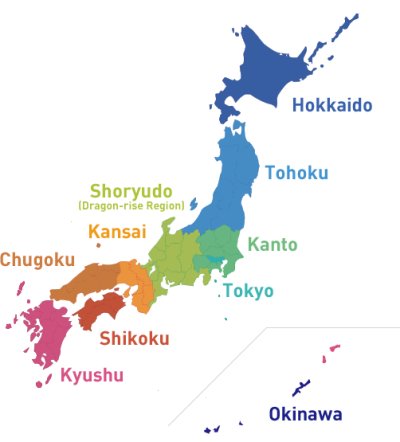 |
The "dragon-shaped" Japanese Archepelago, with Kyushu
(pinkish red region) being the dragon's head.
Image by courtesy of the Japan National Tourism Organization |
Onisaburo says that the Japanese archipelago is a miniature version of the world.
Before getting to that point, let us first look at how the Japanese island chain was formed according to the Reikai Monogatari.
Ancient Japan was part of the Asian Continent, and the Sea of Japan was non-existent. Similarly, the Pacific Ocean was far from being a vast expanse of waters as it was divided by landmasses.
The perennial forces of evil defiled the spirit world of the Earth, turning it into a pandemonium of wicked deities. Kunitokotachi no Mikoto, the parent deity and creator of the planet's spirit world, blew his top. His anger caused natural calamities, submerging the portions of the land known currently as the Sea of Japan and the Pacific Ocean while leaving intact its strongest portions, namely the "dragon-shaped" Japanese Islands. (Vol. 1 of the Reikai Monogatari)
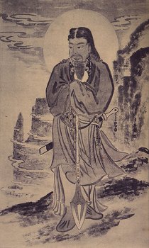 Kunitokotachi no Mikoto, creater of Earth's spirit world
This dragon-shaped archipelago is a perfect duplicate of Kunitokotachi no Mikoto as a pre-morphed golden dragon when he created the muddy sea of the primordial Earth (Vol. 1 of the Monogatari). It is also the place of origin where the golden cylinder stood in the middle of the universe. The cylinder fell over by itself from the northeast to the southwest, turning into a chain of islands. This archipelago thus earned the name "the Self-Fallen Islands" (Onokoro Jima).
The Islands of Onokoro, another meaning of which is "self-curdling" or "self-condensed," appears in the Kojiki ("Records of Ancient Matters").
For details, see SECT. III. - THE ISLAND OF ONOGORO of the Kojiki translated by Basil Hall Chamberlain.
The Onokoro Jima was vested with a mission to serve as the ena ("placenta") of the world.
This group of islands is the current Japanese archipelago. (Imagine the island of Kyushu as the dragon's head and Honshu as its body.)
Then what does Onisaburo mean by the "ena ('placenta') of the world"?
It refers to the idea of Japan being a miniature kata ("model") of the world:
- Passive kata (world -> Japan -> Omoto)
What happens to the world, for good or bad, will happen to Japan, which will in turn happen to Omoto with varying degrees of similarity and extent.
- Active kata (Omoto -> Japan -> world)
What happens to Omoto, for good or bad, will serve as a self-similar model of Japan, which will in turn serve yet another self-similar model of the world on a larger, more dramatic scale.
Note: Just because Japan serves as a model of the world does not mean Japan or Japanese people are superior to others. Onisaburo supports the transmigration of souls, adding that humans are reincarnated time and again to learn love, goodness and other virtues during their earthly sojourns so that they can be "resurrected" to heaven as celestial beings after they leave the material world. In this respect, current Japanese people are Japanese for a reason, but they may have been non-Japanese nationals in their former incarnations just as current non-Japanese nationals may have been Japanese. For details, see How the Spirit World Works
The following are striking geographical similarities between the major islands of Japan and the major continents of the world:
Note: The maps below are by courtesy of FREEWORLDMAPS.NET.
Kyushu: Model of Africa
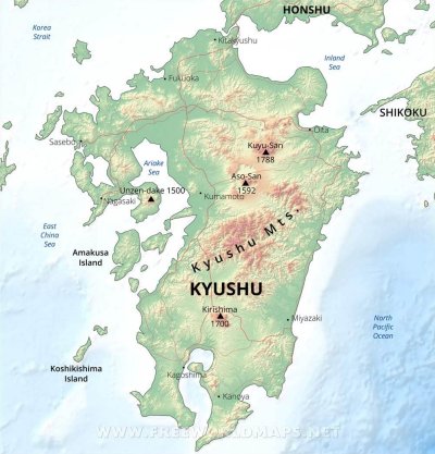 Kyushu, the "head" of the dragon
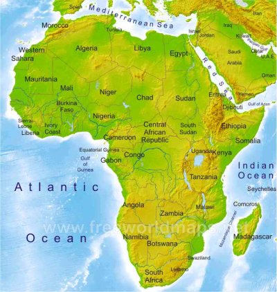 Africa, an enlarged version of Kyushu
Shikoku: Model of Australia
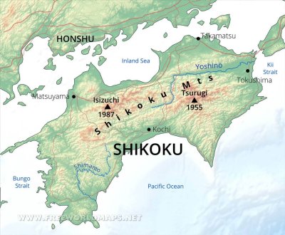 Shikoku
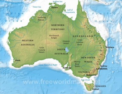 Australia, an enlarged version of Shikoku
Honshu: Model of Eurasia (Europe + Asia)
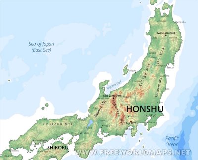 Honshu, the "body" of the dragon
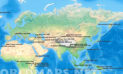 Eurasia (Europe + Asia), an enlarged version of Honshu
Hokkaido: Model of North America
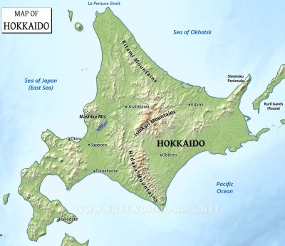 Hokkaido
 Hokkaido, rotated 90 degrees left
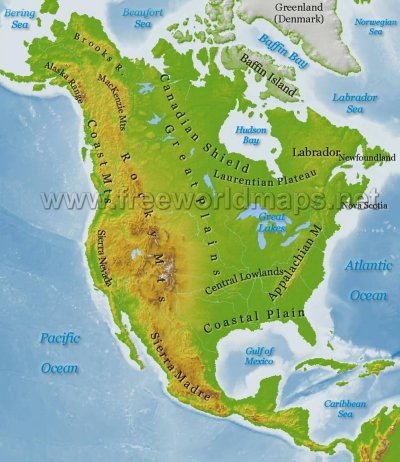 North America, an enlarged version of Hokkaido
Taiwan (= a former territory of Japan): Model of South America
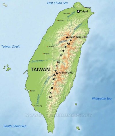 Taiwan
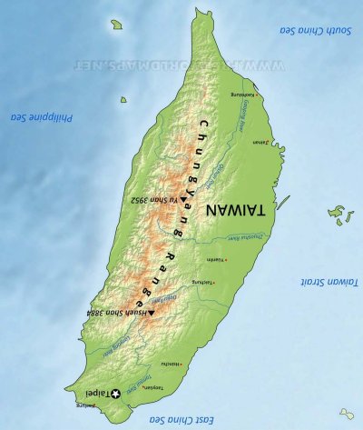 Taiwan, rotated 180 degrees right
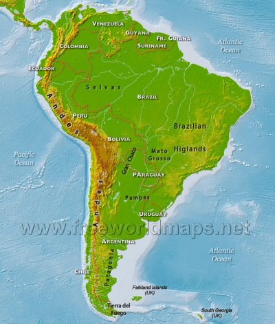 South America, an enlarged version of Taiwan
As shown above, Onisaburo claims that the Japanese main island of Honshu corresponds to Eurasia, the northern island of Hokkaido to North America, the island of Shikoku to Australia, the southern island of Kyushu to Africa, and Taiwan (a former territory of Japan) to South America.
The same principle applies to individual geographical features as follows:
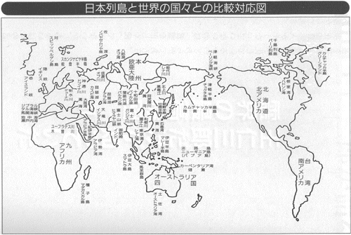 Geographical Correlation between Japan and the World Geographical Correlation between Japan and the World(Excerpts: Reikai no Saikokimitsu by Yasuaki Deguchi. KK Longsellers, 1999.)
Note: Unless otherwise specified, the maps below are by courtesy of Google Maps.
Honshu = Eurasia
The Tsugaru Strait = the Bering Strait
 Tsugaru Strait
 Bering Strait
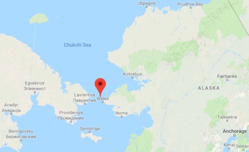
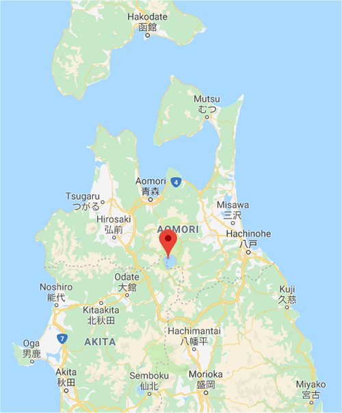
The Tsugaru Peninsula = the Chukchi Peninsula (Russia)
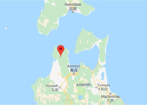 Tsugaru Peninsula
 Chukchi Peninsula
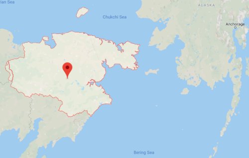
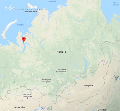
The Mutsu Peninsula = the Kamchatka Peninsula (Russia)
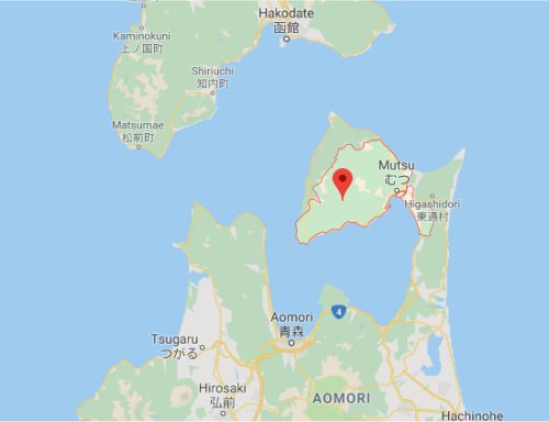 Mutsu Peninsula
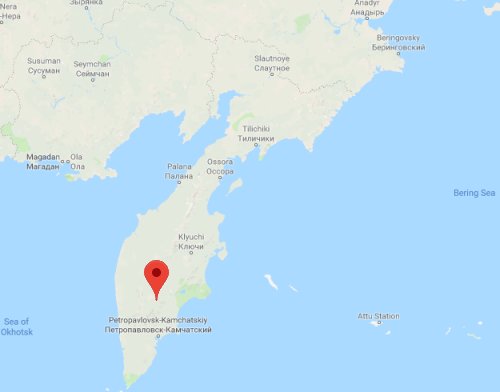 Kamchatka Peninsula
Lake Towada = Lake Baikal
 Lake Towada
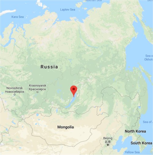 Lake Baikal
The Hachiro Lagoon = the Gulf of Ob
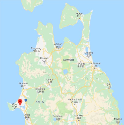 Hachiro Lagoon Once the second largest lake in Japan after Lake Biwa, the Hachiro Lagoon was mostly reclaimed for rice cultivation. Also called the Hachirogata Regulating Pond.
 Gulf of Ob
The Ishinomaki Bay = the Yellow Sea
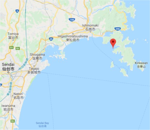 Ishinomaki Bay
 Yellow Sea
The Oshika Peninsula (Miyagi) = the Korean Peninsula (Korea)
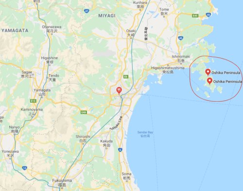 Oshika Peninsula
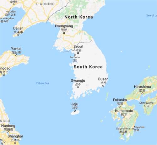 Korean Peninsula
The Kitakami River = the Amur River
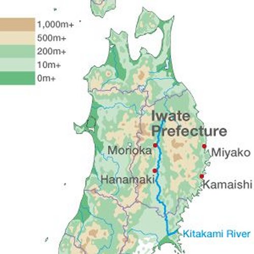 Kitakami River Image by courtesy of nippon.com
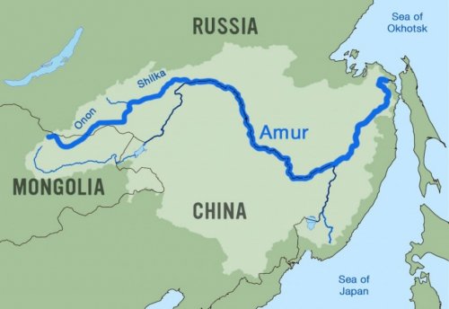 Amur River Image by courtesy of International Rivers
The Abukuma River = the Huang He (Yellow River)
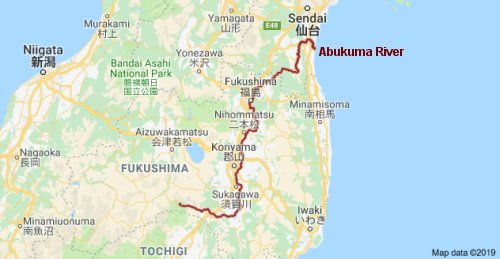 Abukuma River
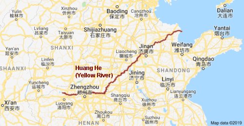 Huang He (Yellow River)
Lake Inawashiro = Lake Balkhash
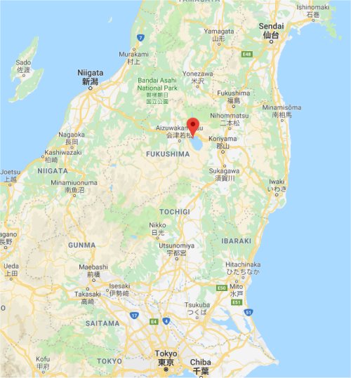 Lake Inawashiro
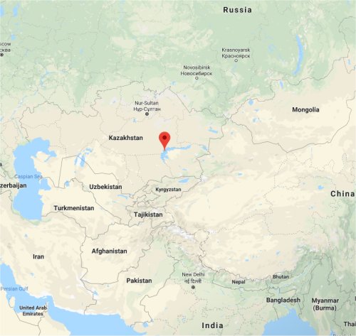 Lake Balkhash
The Tone River = the Yangtze River
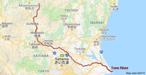 Tone River
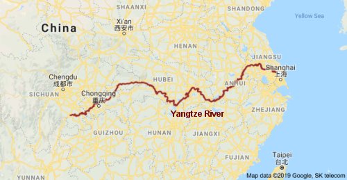 Yangtze River
The Ogasawara Islands = the Maluku Islands
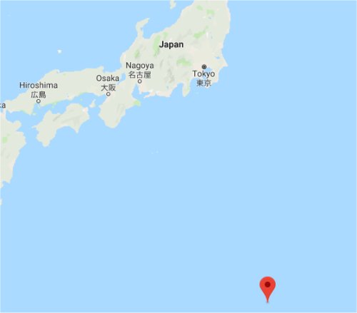 Ogasawara Islands
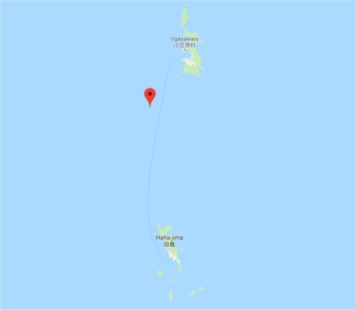 Ogasawara Islands (Close up)
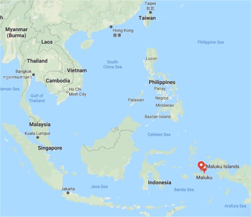 Maluku Islands
The Tokyo Bay = the Gulf of Thailand
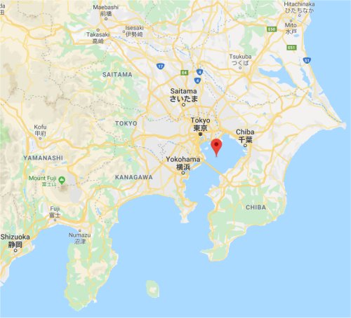 Tokyo Bay
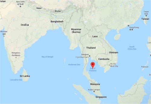 Gulf of Thailand
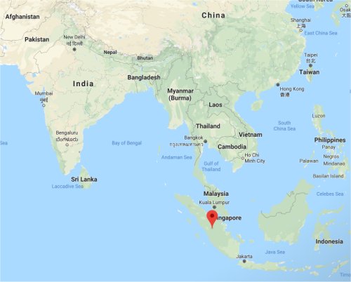
The Izu Peninsula = the Malay Peninsula
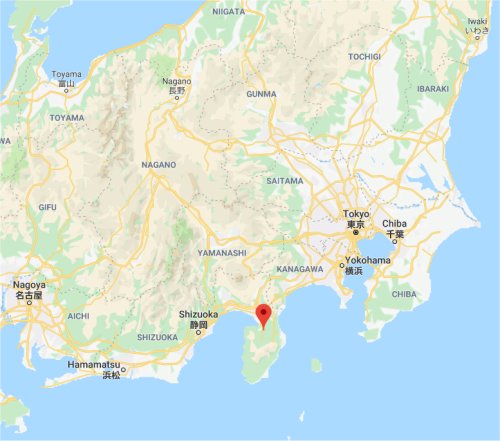 Izu Peninsula
 Malay Peninsula
The Izu Oshima Island = the Sumatra Island
 Izu Oshima Island
 Sumatra Island
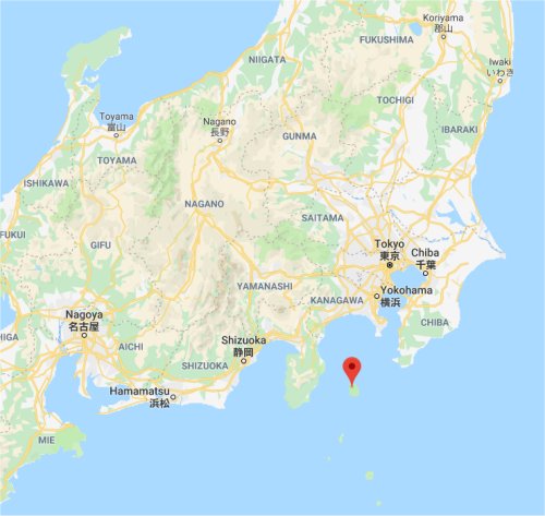
The Omaezaki Peninsula = India
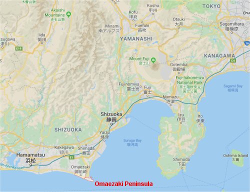 Omaezaki Peninsula
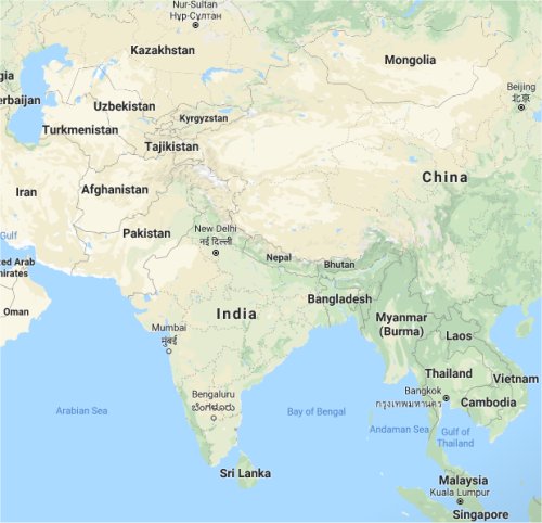 India
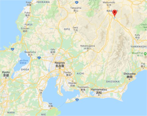
The Fuji Mountains = the Himalayas
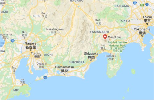 Fuji Mountains
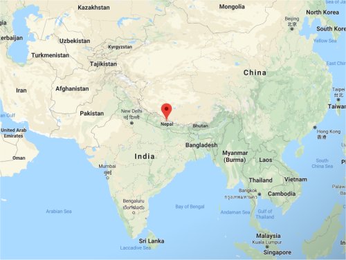 Himalayas
The Fuji River = the Ganges River
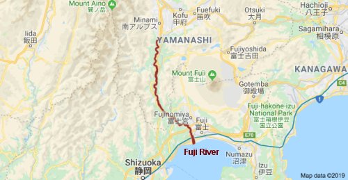 Fuji River
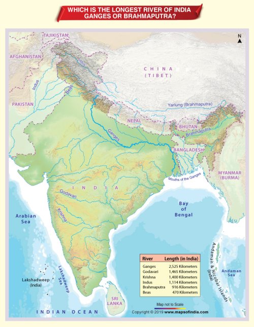 Ganges River Image by courtesy of Maps of India.com
The Tenryu River = the Indus River
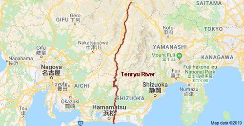 Tenryu River
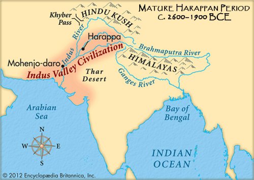 Indus River Image by courtesy of The Better India
The Kiso River = the Euphrates River
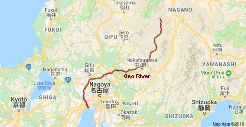 Kiso River
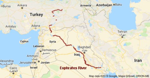 Euphrates River
The Ise Bay = the Persian Gulf (also known as the Arabian Gulf)
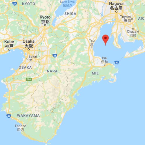 Ise Bay
 Persian Gulf
The Kii Peninsula = the Arabian Peninsula
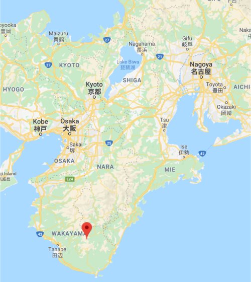 Kii Peninsula
 Arabian Peninsula
Lake Suwa = the Aral Sea
 Lake Suwa
 Aral Sea
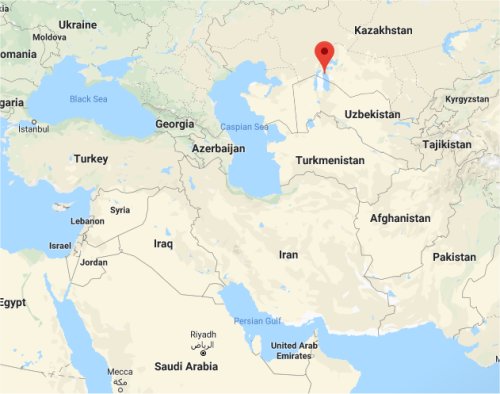
Lake Biwa = the Caspian Sea
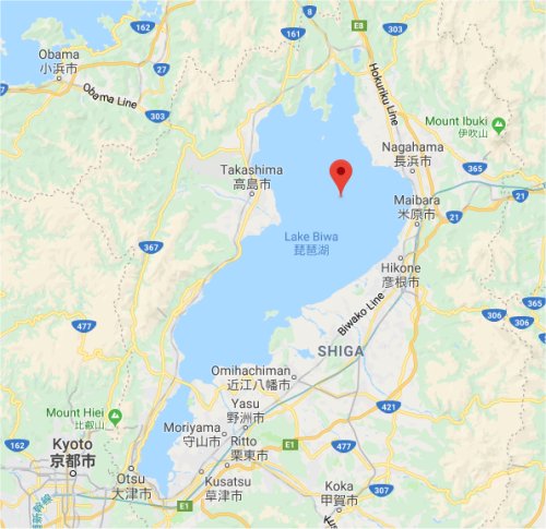 Lake Biwa
 Caspian Sea
The Osaka Bay = the Black Sea
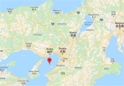 Osaka Bay
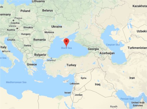 Black Sea
The Nodai River (Niigata) = the Lena River (Russia)
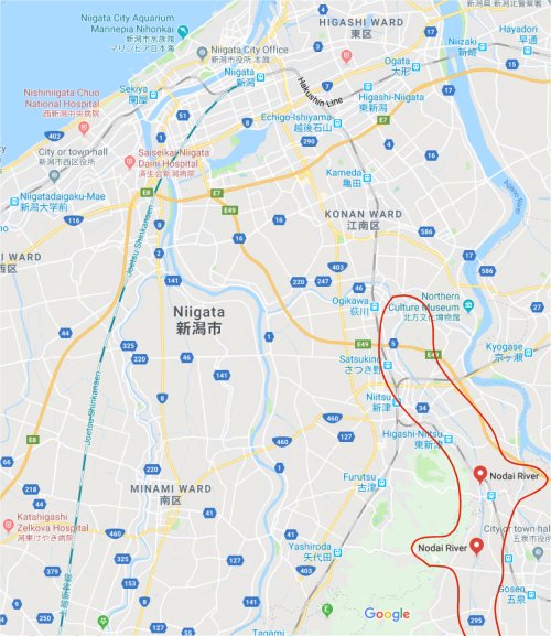 Nodai River
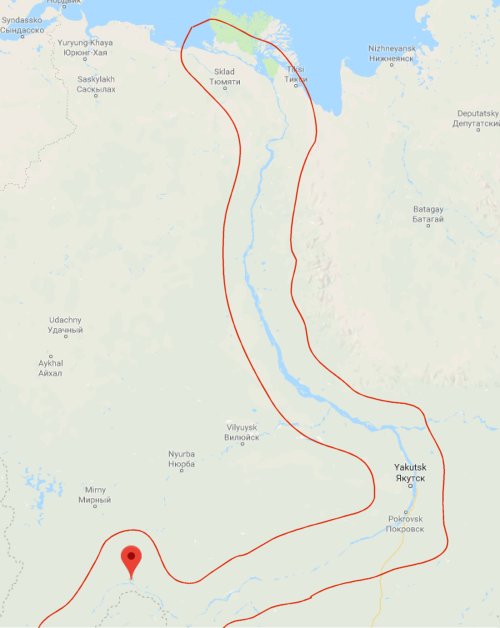 Lena River
The Shinano River = the Ob River
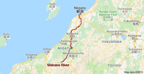 Shinano River
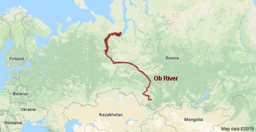 Ob River
The Sado Island = the Novaya Zemlya Islands
 Sado Island
 Novaya Zemlya Islands
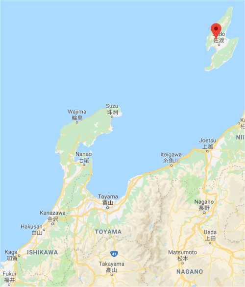
The Noto Peninsula = the Scandinavian Peninsula
 Noto Peninsula
 Scandinavian Peninsula
The Jinzu River = the Northern Dvina River
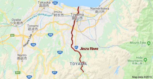 Jjinzu River
 Northern Dvina River
The Awaji Island = the New Guinea Island
 Awaji Island
 New Guinea Island
The Seto Inland Sea = the Mediterranean Sea
 Seto Inland Sea
 Mediterranean Sea
The Oki Islands = United Kingdom and Ireland
 Oki Islands
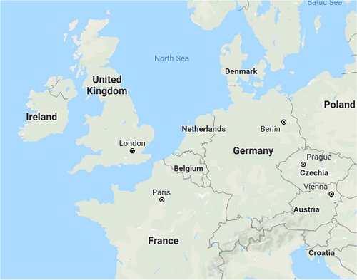 United Kingdom and Ireland
The Kanmon Strait = the Strait of Gibraltar
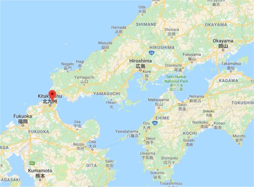 Kanmon Strait
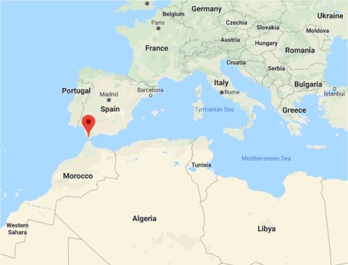 Strait of Gibraltar
The Iki Island = Iceland
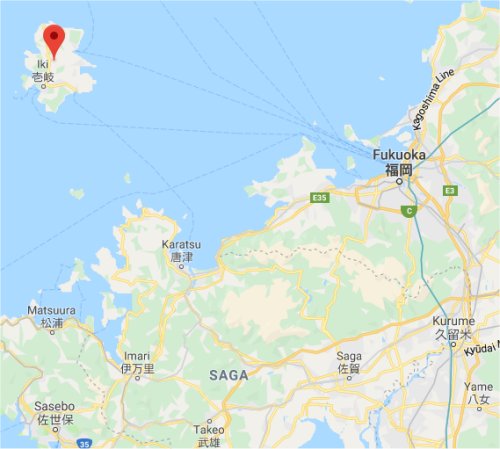 Iki Island
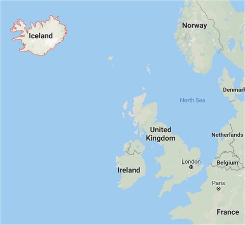 Iceland
The Tsushima Islands = the Svalbard Islands
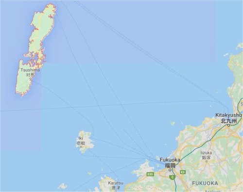 Tsushima Islands
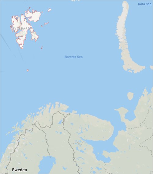 Svalbard Islands
Hokkaido = North America
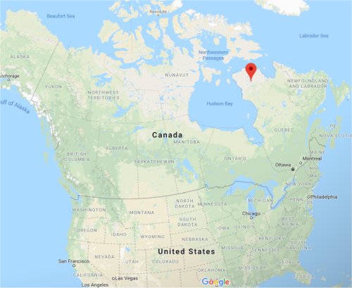
The Nemuro Bay = the Hudson Bay
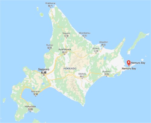 Nemuro Bay
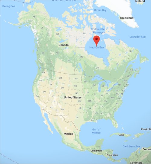 Hudson Bay
The Kuril Islands = the Queen Elizabeth Islands (formerly known as the Parry Islands)
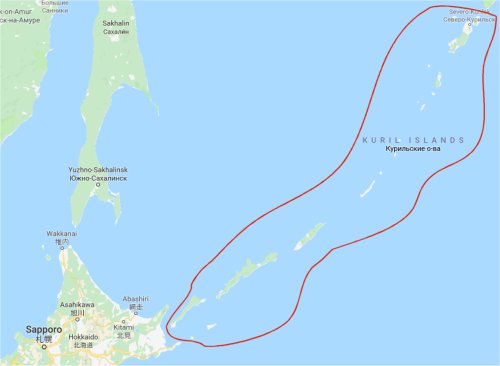 Kuril Islands
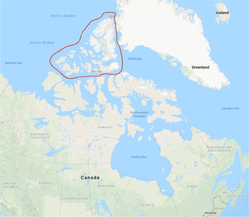 Queen Elizabeth Islands
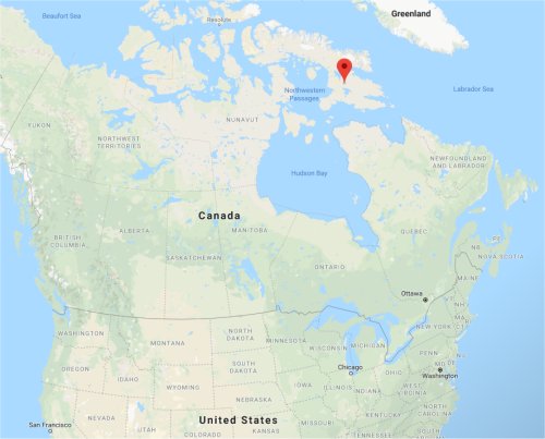
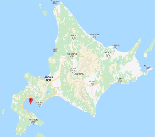
The Kunashiri Island = the Labrador Peninsula
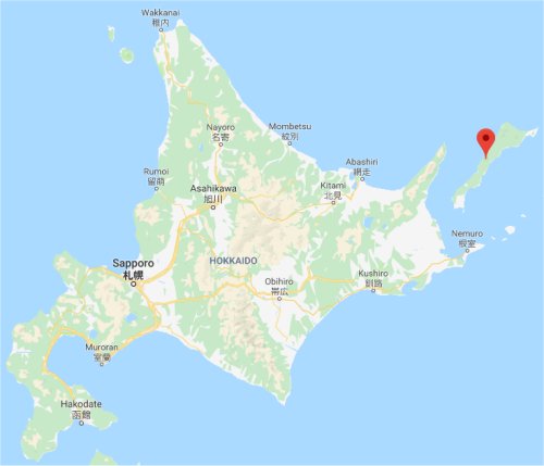 Kunashiri Island
 Labrador Peninsula
Sakhalin (former Japanese island) = the Baffin Island
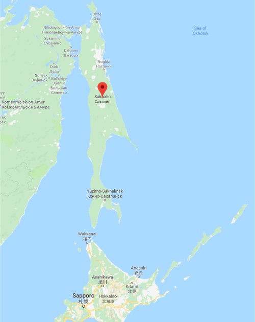 Sakhalin
 Baffin Island
The Uchiura Bay = the Gulf of Mexico
 Uchiura Bay
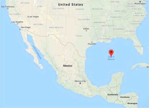 Gulf of Mexico
Shikoku = Australia
The Tosa Bay = the Great Australian Bight
 Tosa Bay
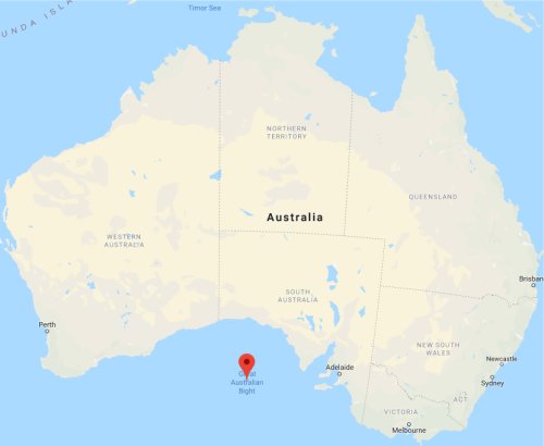 Great Australian Bight
The Hiuchi Open Sea = the Gulf of Carpentaria
 Hiuchi Open Sea
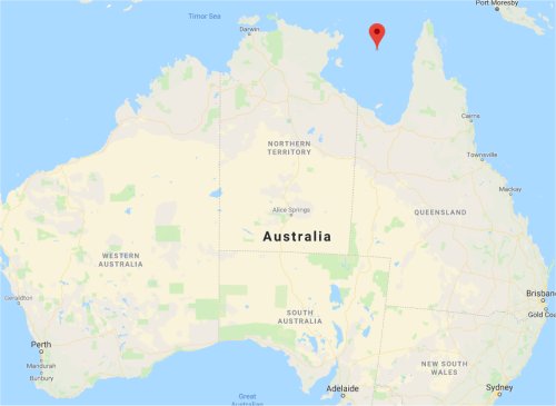 Gulf of Carpentaria
Kyushu = Africa
The Tanegashima Island = the Madagascar Island
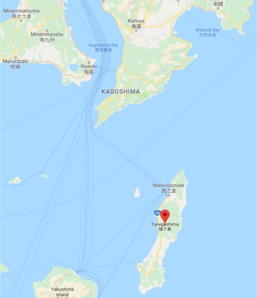 Tanegashima Island
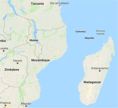 Madagascar Island
Taiwan = South America
Now turn to some incidents from Omoto's annals that seem to exemplify the idea of kata (model), where events of divine importance occur through fractal patterns:
[1]
- Jul. 22, 1934: The Showa Shinseikai was inaugurated at the Armed Forces' Hall at Kudan in Tokyo.
- Jul. 22, 1940: The Second Konoe Cabinet was
formed at the Armed Forces' Hall at Kudan in Tokyo.
The chairman of the Showa Shinseikai was Onisaburo Deguchi, and the vice chairman was Ryohei Uchida, a pioneer in the Japanese right-wing movement. Similarly, the head of the Konoe Cabinet was Prime Minister Fumimaro Konoe, and his appointed War Minister was Hideki Tojo, a right-wing militarist who later became prime minister.
[2]
- Dec. 8, 1935: The Second Omoto Incident
broke out.
- Dec. 8 (Japan time), 1941: Japan's attack
on Pearl Harbor triggered what the Japanese call the Pacific War.
The Tokkotai (special secret service police) launched a
sneak attack on Onisaburo, who stayed at Omoto's Matsue branch along Lake
Shinji, whereas the tokkotai (suicidal banzai unit) launched a sneak
attack on the U.S. Pacific fleet, which was at anchor along Pearl Harbor.
As an aside, the dawn of December 8 is the de facto birthday
of Buddhism, when Gautama Buddha attained enlightenment under the bo tree,
looking up at the bright morning star.
[3]
- Apr. 18, 1936: The holy sanctuaries of Ayabe
and Kameoka were unlawfully forfeited and sold.
- Apr. 18, 1942: The first aerial bombing of
Tokyo by U.S. aircraft.
Besides the forfeiture of Omoto's two holy sanctuaries, its local chapters
and other facilities were all destroyed. Onisaburo once said that Ayabe
was a model of the Grand Shrines of Ise (summit of all Japanese Shinto
shrines), and Kameoka, a model of Tokyo. Truly, 6 years later, Tokyo, Nagoya, Kobe and other big cities were bombed by sixteen U.S. aircraft. The Grand Shrines
of Ise were not spared, either.
[4]
- Sep. 8, 1945: The Supreme Court pronounced
Omoto innocent to end the perennial court battle.
- Sep. 8, 1951: Japan signed the peace
treaty in San Francisco to end the Pacific War and the ensuing occupation
by the Allied Forces.
The number of suspects who appealed it to the Supreme Court was
48 except Onisaburo and his wife Sumi. Meanwhile, the number of nations
which attended the signing of the peace accord in San Francisco was 48
except Japan.
The Second Omoto Incident was resolved on Sep. 8, 1945;
on the same day, General Douglas MacArthur and his 15,000 soldiers including
the 8,000 cavalry set foot on Japanese soil, making them the very first
foreign army to occupy the country since its foundation.
Incidentally, Onisaburo had been in jail for 6 years and 8 months,
or 2,435 days from Dec. 8, 1935 to Aug. 7, 1942 (including two leap
years), while Japan had been under the Allied occupation for 6 years and
8 months, or 2,435 days from Aug. 28, 1945 (when the Allied advance contingent
arrived at the air base in Atsugi) to Apr. 27, 1952 (the day before the
enactment of the peace treaty in San Francisco) (including two leap years).
The Second Omoto Incident had extended for 9 years and 9 months
from Dec. 8, 1935 to Sep. 8, 1945, while the Pacific War had lasted
for 9 years and 9 months from Dec. 8, 1941 to Sep. 8, 1951.
Just as Onisaburo abandoned the right to seek compensation for
the Second Omoto Incident, the Allied Powers abandoned their right to seek
indemnities from Japan. Just as the holy sanctuaries of Ayabe and Kameoka
were unconditionally reverted to Omoto, the Allied Nations reverted the
Japanese Archipelago undivided.
As miniature versions of Japan and the world, Omoto served bad models as well.
A classic example would be Hisa Fukushima, the third daughter of Foundress Nao Deguchi. Based on her revelations coming from wicked deities, Hisa made every effort to slander Onisaburo and get in his way. Herein lies the airtight plot of the Kami's drama. In other words, the Kami let Hisa play the villain to proactively create a model where evil deities would surrender to the Kami and repent.
|
|
|